Special Edition Day 10 May 17, 2001
_____________________________________________________________________________________
The Fort Edwards Archaeologist
_____________________________________________________________________________________
Report on the Archaeological Excavations at Fort Edwards, home site of Joseph
Edwards and a French and Indian War frontier fort of Col. George Washington.
This archaeological excavation is part of the ongoing project of The Fort Edwards Foundation of Capon Bridge, West Virginia, to preserve, protect and iterpret the home site and fort site at Joseph Edwards's land grant on the banks of the Cacapon River in Hampshire County, West Virginia. This site represents both an early settler's home of the second quarter of the eighteenth century and a French and Indian War fort in Col. George Washington's chain of forts protecting the Virginia frontier. The excavation is under the direction of Dr. Stephen McBride of Wilbur Smith Associates of Lexington, KY. This page is one of a series of reports on the work.
___________________________________________________________________________________
Day Ten - We Have a Fort!

Is it Really There?
The tenth and last day began with everyone checking on the feature we found yesterday. We just wanted to make sure it did not disappear overnight or that it had not been our imagination yesterday making us think we had a bastion like feature. Dr. McBride and Greg began the process of cleaning more area around the feature so we could see where its ends went.
More Test Probes
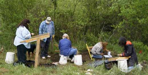
Our volunteers got back to work on the STPs and enlarged probes which had given us such nice artifacts over the last few days.
Covering the Map
While most workers were digging deeper or expanding their work, Kurt was busy getting it all on the map. With some help from Jim, he was precisely noting every location of a feature or artifact and storing the information in the survey instrument memory so that later he can download it and create a site map with everything on it.


 These picture show Jim holding the target that is placed on the feature. First, he carefully centers the target on the feature. Then he levels the target by centering the bubble in the level by his right hand. Finally, he looks through the viewer window to insure he has the target mirror pointed toward Kurt and the survey instrument. Then Kurt takes a sighting and the survey instrument does all the rest. The location is precisely recorded.
What's In the Hole?
The features that Kurt was mapping included all kinds of remnants of human occupation.

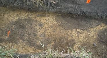
The rocks protruding from the wall of the trench may indicate a foundation. The dark feature on the right is unknown, but shows us that we may have to come back sometime and enlarge this feature to find out what it is.

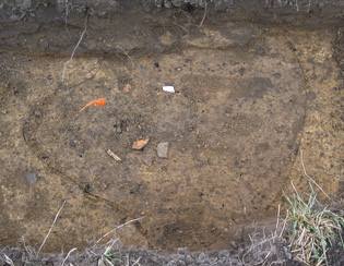
The orange mark on the left indicates something was burned at high temperature. The mark on the right is very distinct and probably too large to be a post mark. Guess we still have many questions to answer.
Checking Soil Type
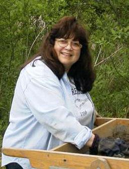
 Cathy seems to have no more features to draw so here she is checking the soil type from a test probe. She has a sample of the soil on her trowel and is comparing it to color samples in the book. This way she can make better notes on what soils are at the site and where they are located.

Adrenalin Rush
 Back at the bastion feature the excitement was rising. Everyone gathered around as Dr. McBride took an elevated ride on our special purpose, archaeological, photographic, agricultural implement. The Case 485 was rolled up to the trench where Dr. McBride, Greg and Keith had been busy expanding their trench to expose more of this exciting feature. Now it was time to photographic it and let everyone have a look. From the elevated tractor bucket one could clearly see the feature.

 lower left corner at about a 45 degree angle up toward the top of the picture. It then makes a sharp turn back and runs toward the bottom right of the photo. Then it makes another turn and goes toward the upper right of the picture disappearing in the dirt just before the center right edge of the picture. This configuration is somewhat reminiscent of a style of fort drawn by Benjamin Franklin during the French and Indian War as shown in the drawing above right. Note: this drawing is not of our feature; it simply shows the use of


 Our new Volunteers of the Day were Mike and Judy Rose of North River Mills. We do owe them an apology for not letting them know that the work day started later than advertised. They were real early birds.